ÁHUGAVERÐIR STAÐIR OG ÞJÓNUSTA
Í NÁGRENNI VIÐ KARTÖFLUGEYMSLUNA
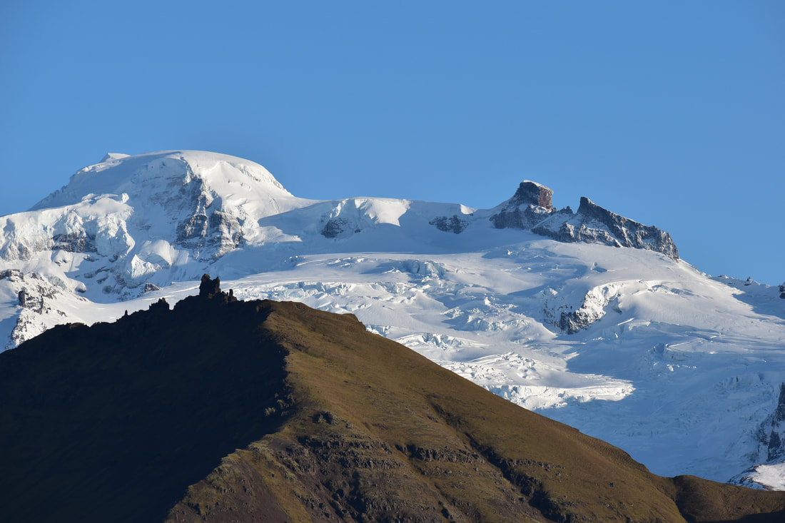
Kartöflugeymslan er í Löngutorfu í Svínafelli í Öræfum. Afleggjarinn að húsinu er vestan við móttökuna á tjaldsvæðinu í Svínafelli. Það er gott útsýni yfir Skeiðarárjökul og Skaftafellsfjöll til vesturs og oft einstaklega falleg sólsetur. Það er um 45 - 55 km akstur að Fjallsárlóni og Jökulsárlóni þar sem eru bátasiglingar á sumrin. Skipulagðar ferðir eru út í Ingólfshöfða á sumrin. Skaftafell er í um 8 km fjarlægð, þar eru merktar gönguleiðir um stórbrotið landslag. Margir aðilar bjóða upp á jöklagöngur o.þ.h.
TIL VESTURS:
Freysnes: 3.2 km Við þjóðveg. Bensínsstöð, veitingasala, nauðsynjavörur, minjagripir.
Glacier & Volcano Expeditions meeting point.
Local Guide meeting point.
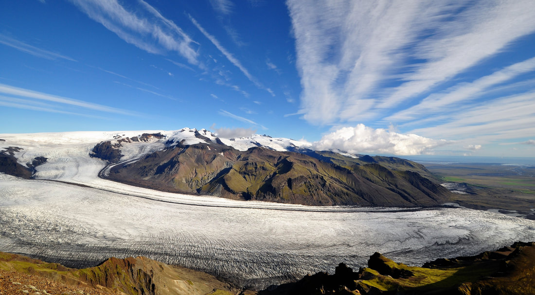
Svínafellsjökull: 3.5 km. Spectacular landscape with the outlet glacier Svínafellsjökull. This scenery has played a roll in many recent movies such as Batman Begins, Interstellar, Tomb Raider, Game of Thrones and others.
TIL VESTURS:
Freysnes: 3.2 km Við þjóðveg. Bensínsstöð, veitingasala, nauðsynjavörur, minjagripir.
Glacier & Volcano Expeditions meeting point.
Local Guide meeting point.
Svínafellsjökull: 3.5 km. Spectacular landscape with the outlet glacier Svínafellsjökull. This scenery has played a roll in many recent movies such as Batman Begins, Interstellar, Tomb Raider, Game of Thrones and others.
Skaftafell Airport: 6.6 km on Road No.1. Sightseeing flights, tour centre.
Skaftafell/Vatnajökull National Park: 8 km on Road No.1.
Svartifoss: Easy/moderate hike to Svartifoss waterfall with basalt columns.
Skaftafellsjökull: Easy hike to the outlet glacier Skaftafellsjökull.
Sjónarnípa: Moderate/challenging hike to the view point Sjónarnípa. Fantastic view over Skaftafellsjökull glacier towards Hvannadalshnjúkur, the highest peak in Iceland.
Kristínartindar: Long, challenging hike to Kristínartindar, the highest peak in Skaftafell with magnificient views on the way.
Other hiking trails and general information at vjp.is.
Kirkjubæjarklaustur: 73 km on Road No.1. Gas station, restaurants, health care centre, pharmacy, liquor store.
Kirkjugólf: Basalt column “Church floor”.
Systrafoss: Waterfall in the town of Kirkjubæjarklaustur.
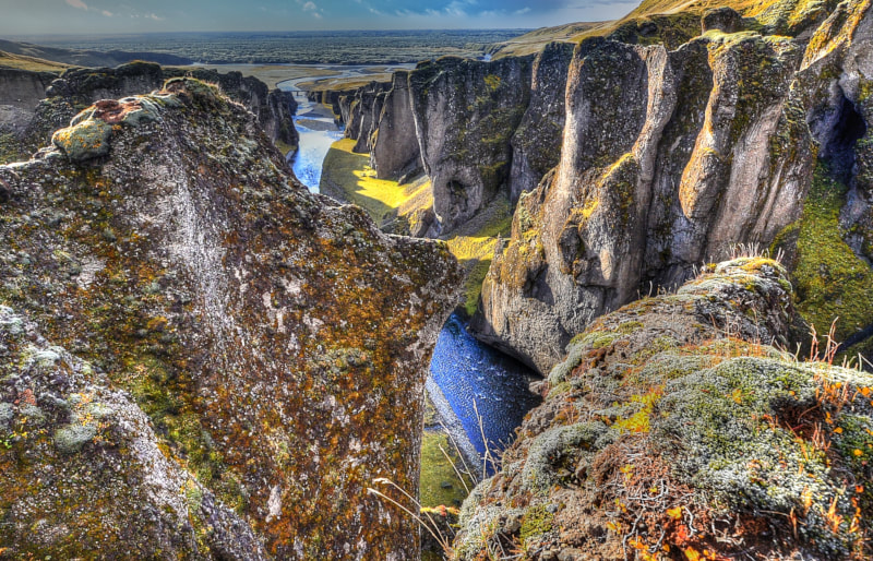
Fjaðrárgljúfur: 82 km. (79 km on Road No.1 + 3 km on F-road 206). Spectacular canyon, hiking trail.
Kirkjugólf: Basalt column “Church floor”.
Systrafoss: Waterfall in the town of Kirkjubæjarklaustur.
Fjaðrárgljúfur: 82 km. (79 km on Road No.1 + 3 km on F-road 206). Spectacular canyon, hiking trail.
Laki/Lakagígar: 129 km (79km on Road No.1 + 50 km on rugged F-road 206, 4x4 only, unbrigded rivers!).
Attn.: traveltime on F206 only is approx. 1,5 to 2 hours one way!
Lakagígar: 25 km long row of volcanic craters from the 1783 Laki Eruption, one of the biggest eruptions in history.
Landmannalaugar: 175 km (100 km on Road No.1 + 75 km on rugged F-road 208, 4x4 only, unbrigded rivers).
Attn.: traveltime on F206 only is approx. 1,5 to 2 hours one way!
Lakagígar: 25 km long row of volcanic craters from the 1783 Laki Eruption, one of the biggest eruptions in history.
Landmannalaugar: 175 km (100 km on Road No.1 + 75 km on rugged F-road 208, 4x4 only, unbrigded rivers).
From The Potato Storage to the east:
Glacier Horses: horseback riding, 2 km on Road No.1, right turn at the sign, approx. 1km on gravel road.
Háalda: 9 km on Road No.1. Viewpoint, elevated from the surroundings due to massive floods after the 1727 eruption of Öræfajökull volcano.
Fagurhólsmýri: 19 km on Road No.1. Café Vatnajökull, gas station (self service).
Kvíarmýrarkambur/Kvíárjökull: 31 km on Road No.1. Remarkably well preserved lateral morains dating back about 5.000 years. During the maximum of the Little Ice Age about 1900, the Kvíárjökull has fulfilled the whole lateral moraine complex.
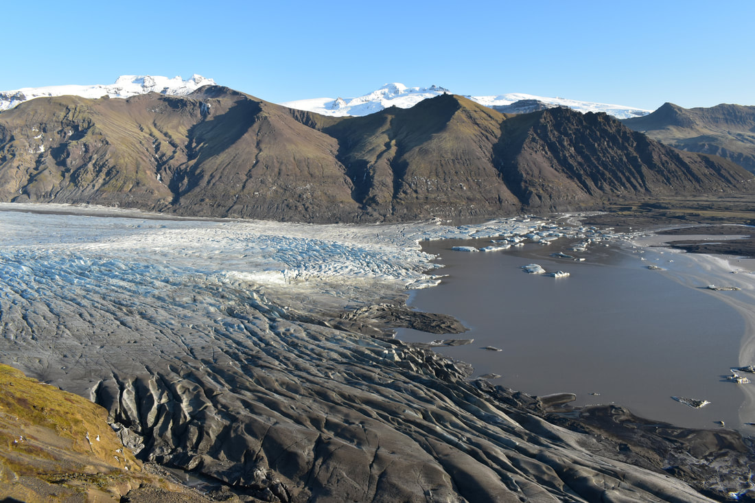
Fjallsárlón: 42 km on Road No.1. Glacial lagoon at the snout of Fjalljökull. Restaurant, boat trips.
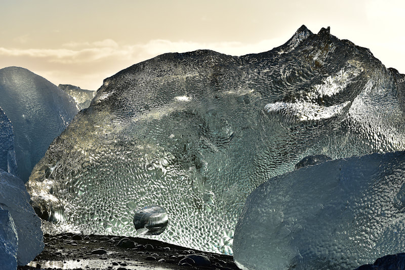
Jökulsárlón: 51 km on Road No.1. Glacial lagoon at the snout of Breiðamerkurjökull, Café, boat trips.
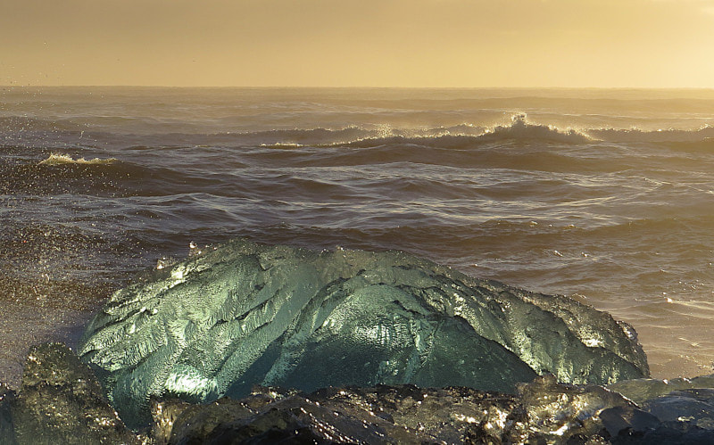
Diamond Beach: 51 km on Road No.1. Black sand beach, some times packed with glittering chunks of ice from Jökulsárlón.
Glacier Horses: horseback riding, 2 km on Road No.1, right turn at the sign, approx. 1km on gravel road.
Háalda: 9 km on Road No.1. Viewpoint, elevated from the surroundings due to massive floods after the 1727 eruption of Öræfajökull volcano.
Fagurhólsmýri: 19 km on Road No.1. Café Vatnajökull, gas station (self service).
Kvíarmýrarkambur/Kvíárjökull: 31 km on Road No.1. Remarkably well preserved lateral morains dating back about 5.000 years. During the maximum of the Little Ice Age about 1900, the Kvíárjökull has fulfilled the whole lateral moraine complex.
Fjallsárlón: 42 km on Road No.1. Glacial lagoon at the snout of Fjalljökull. Restaurant, boat trips.
Jökulsárlón: 51 km on Road No.1. Glacial lagoon at the snout of Breiðamerkurjökull, Café, boat trips.
Diamond Beach: 51 km on Road No.1. Black sand beach, some times packed with glittering chunks of ice from Jökulsárlón.
Hali: 64 km on Road No.1. Restaurant, Museum.
Heinabergsjökull: 99 km (89 km on Road No.1. + 10 km on secondary gravel road, 4x4 only). Glacial lagoon, kayak tours (see Flatey).
Flatey: 93 km on Road No.1. Dairy farm/Restaurant. Tour centre for glacier walks, ice cave and kayak tours.
Höfn í Hornafirði: 130 km on Road No.1. Town, super market, restaurants, swimming pool, post office, bank, pharmacy, liquor store.